

Holme Moss
Rising to the west of Holmfirth on the edge of the Peak District National Park is Holme Moss, with its 228m high radio transmitter station which can been seen for miles around.
The summit plateau comprises mainly of peat bogs and only footpaths cross here. One is the long distance Pennine Way, which now has flagstones to protect the vulnerable peat from the feet of the many walkers making their way north to Kirk Yetholm or south to Edale.
The road to the summit is a favourite among the road biking community. It’s a regular feature on the Tour of Britain race and was a highlight of Day 2 of the 2014 Tour De France Grand Depart.
So, with no permissible routes over the top for mountain bikers and just two roads crossing this bulk of bleak and barren moorland, the A6024 Holme Moss Road and the A635 Greenfield Road, what does this behemoth have to offer the off road cyclist?
I have grown up riding the trails around Holmfirth, hence the name of my guiding business, and I have walked and ridden many of the areas surrounding the summit of Holme Moss. However, until recently, I had never linked them together.

Springs Road above Digley
In early 2020 with the country on lockdown and only essential travel permitted, it made sense to explore from the doorstep.
Initially for me this meant walks in the local woods as the Singletrack Mag, ’No Car, No Gnar, Not Far’ message was spreading amongst the Mountain Bike community. As exercise restrictions lifted, I got the bike out, only going a short distance from home but it was good to be pedalling again.
Three months in and we were allowed to travel for exercise, but I still didn’t want to use the van to get to the trails. After all, I’m lucky to have some fantastic places on my doorstep. But it was time to venture further than my regular circuit.
So one morning, I sat down with a coffee and got the maps out to trace a line around Holme Moss. My aim was to find a route that stuck as close to the edge as possible, using only permitted rights of way with as little road work as possible.
With the route plotted and knowledge of what some of the trails were like, it was time to explore. I was initially going to go in a clockwise direction, but on looking at the profile of the final section I didn’t fancy having the steepest and toughest climbs right at the end of what would be a long day in the saddle, and so I reversed the route on my Garmin and set a date to head out.
Wednesday 24th of June was forecast to be the hottest day of the year, but it was the date I had planned for so I packed plenty of food and water and set off. Riding from home, I was in for an 85Km day - the routes listed below are shorter as I first had to get to the trailhead.
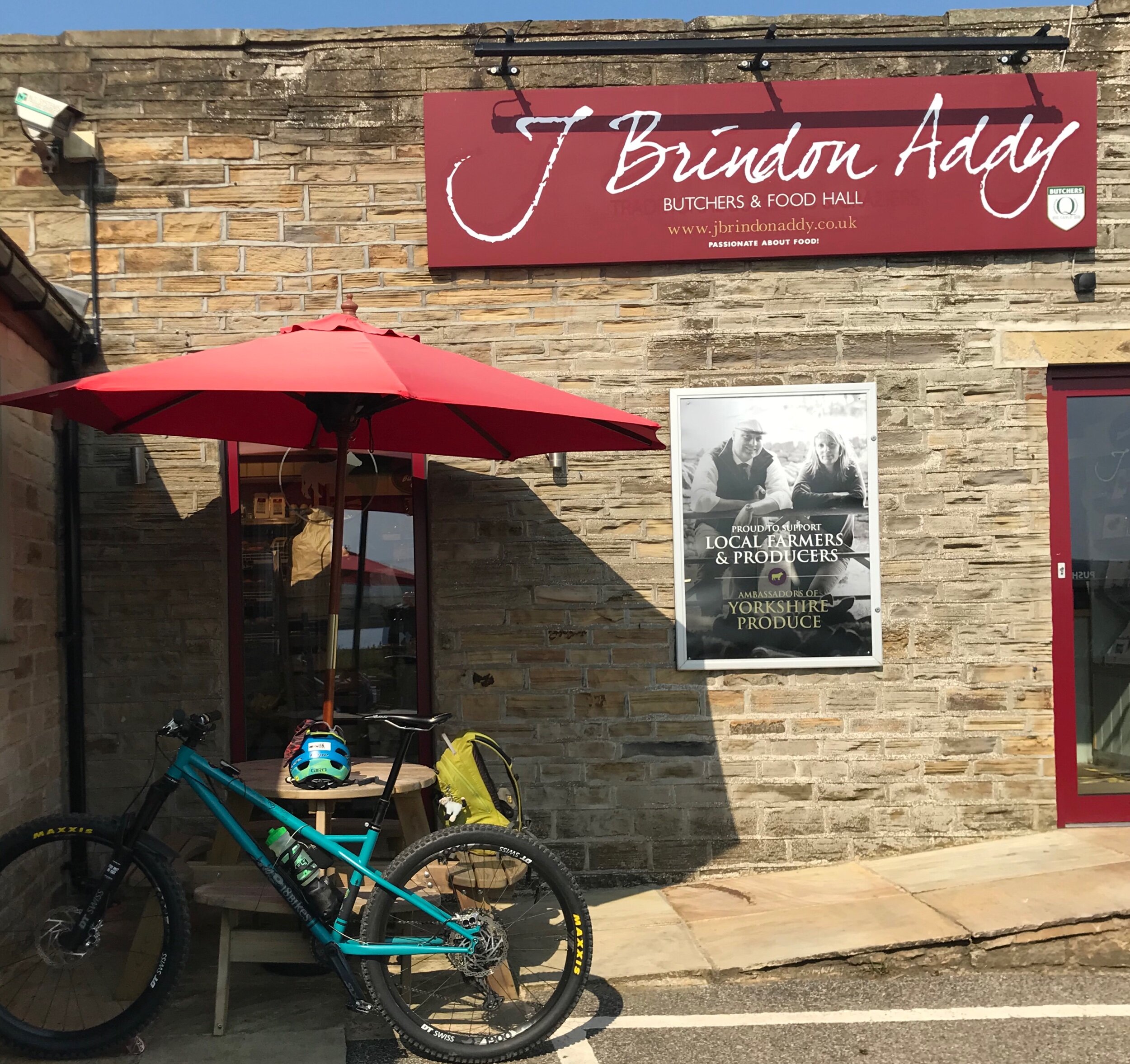
Home of the best Pork Pie
My first stop was J Brindon Addy’s Butchers home of the best pork pies in the world. With a couple in my pack for lunch, I set off. Climbing out of Hade Edge I was soon off road and descending the rough and rocky trail known as Ramsden Road. Holme Moss summit was tantalisingly close in front of me and as I emerged from trail to tarmac near Lane village there were already plenty of road bikers tackling the long climb to the top. But I was going down, heading through Holme Village towards Digley Reservoir, and the climb up Nether Lane and Springs Road with its old grooved flagstones worn by the passing of horse and carts many many years ago.
A brief stint on the A635 led to a right turn at Snoopy’s Cafe, a conveniently placed butty van where the Pennine Way crosses on its descent from Black Hill/Soldiers Lump. It’s a popular stop for passing motorists and an institution for some.
I was now heading down the Wessenden Valley towards Marsden. This descent has a mix of wide gravel tracks, steep stone pitched sections and bracken edged singletrack. Ride Kirklees advocacy group have carried out some trail maintenance on some of the boggy sections, reinstating some old drains, but today it was hard packed, dry and fast.
A long descent in the bag, it was time to climb up out of West Yorkshire and drop down into Greater Manchester. Spinning the legs steadily up past Marsden Golf Club I was soon at the permissible Bridleway of the Standedge Trail, traversing the moor above Redbrook Reservoir and avoiding the busy A62.
At the side of Brunclough Reservoir with the villages of Diggle, Uppermill and Greenfield far below, I stopped for lunch and let the legs recover. Dropping into the valley, a friendly resident kindly topped up my water bottles. It was here that I also met Duncan Philpott, legendary mountain bike photographer and Stefan Amato founder of PannierCC. They were out on their gravel bikes and, having set off from Wortley near Sheffield, it turned out that they were tracking a similar route to me.

Wise words from Tameside Council
Bottles filled, we rode on to pick up the Pennine Bridleway, a fast flat section between Diggle and Greenfield. The gravel bikes sped off into the distance, but our routes would soon split anyway as they stuck to the smoother old railway line and canal towpath while I followed the Pennine Bridleway, first on good tracks over to Carrbrook, then rougher rockier trails into the Brushes Valley. From here, it was steady climbing up the valley towards Higher Swineshaw Reservoir.
It was nice to get a brief respite from the heat as the climb started up a tree lined private road to Higher Swineshaw Reservoir. Soon enough though, it was back out into the open and into the full heat of the day. The temptation for a dip in the reservoir was strong.
I continued up and over to Tintwistle on excellent tracks, rocky in places with a feeling of isolation dropping into Ogden Clough and passing another opportunity for cooling dip in the brook.
At Tintwistle, I had a choice. Depending on how I felt, I could either drop down onto the Trans Pennine / Longdendale Trail for a fast blast on the disused railway of the old Sheffield to Manchester Line, or stick with the original game plan of following as close to the Saddleworth Massif as possible.
With plenty of food and water and feeling good, I decided to stick to the plan and followed the Northern Horse Route as it wove its way alongside the very busy A628, criss crossing its way up the valley. I thought this section would be a laborious slog with the noise of the road taking away any sense of peace and tranquility, but there was a strange feeling of calm as I rode along empty trails, comprising of old lanes, disused railways and wooded singletrack, with the only occasional noise of the road reminding me of life outside of my little bubble of turning the pedals.
The perfectly placed Crowden Campsite provided my second water refill of the day and I stopped to chat to the warden about the current lockdown situation and the effect it was having on the camping and caravanning industry.

St James Church, Woodhead
I pushed on up the valley passing the quaint St James’ church where some of the navvies who died during the construction of the Woodhead Tunnels are said to be buried.
Shortly after passing the church, I was on a section where I thought I might have to brave the road, passing the turning on the left up the backside of the Holme Moss (A6024) and crossing Woodhead bridge before turning off the road again below Pikenaze Hill. However, there is a permissible Bridleway (thank you Northern Horse Route) which heads up and alongside the A6024, crossing this at Oakside Bridge before heading back towards the A628 and back up the Woodhead Valley towards the Longdendale trail where it crosses from Derbyshire into South Yorkshire at Salter’s Brook Bridge.

Nearing the end of a long day……
From here you cross the busy A628 for the last time, directly opposite the Dunford Bridge road and head down towards the village. Turning left just before reaching the bottom of the hill, towards Winscar Reservoir, and riding over the dam wall and through the car park, means that you cut off a big chunk of road climbing. It’s then just a short way to the top before the descent down Snittle Road back to Hade Edge and a well earned beer.
I on the other hand had another 10k to ride home!
With my legs beginning to stiffen, I made my way back on quiet roads happy that the route was everything and more than I hoped it would be.
So there you have it a big day out around a big old lump of moorland.
What are the trails like?
Most are well surfaced rocky trails and only a few sections along the Northern Horse Route would be boggy in wet weather. I was surprised how little actual road work there was considering the distance covered, I cannot give you an actual ratio but all the roads I took were quiet back lanes, and the only real traffic hazards are the A635 and crossing the busy A628.
What Bike would you recommend?
A short travel trail bike would certainly be a comfortable option on some of the more rocky sections of the route, but I rode it on my 18 bikes, No7, 27.5” hardtail and it was more than up to the task.
As I mentioned earlier, I bumped into Duncan and Stefan who were doing a similar route to me but on their gravel bikes, so I would say as long as you were ok with rocky loose terrain you’d be fine on a gravel bike - just be prepared for punctures and a bit of pushing/carrying.
I will put two route files below, one for mountain bikes and one more suited to gravel bikes. Which you choose is entirely up to you.

Stunning views all day long
Are there facilities en-route?
At the time of riding and writing, we were in a the grip of a global pandemic and most cafes and pubs were closed. But if you’re reading this when the world is back up and running, then there are numerous places to stock up en-route as you pass through the villages of Holme, Marsden, Uppermill and Greenfield. Crowden Campsite has a little shop, but this was closed at the time of writing as was the small shop/brew stop at the side of the Fleece pub in Holme Village. Then there’s also Snoopy’s Butty Van (maybe seasonal) on the A635 Greenfield Road.
Where’s the best starting point?
There are plenty of places to start the route. However, I wanted to get the more technical trails out of the way while my legs were still fresh, so I would say the best place to start is Hade Edge and go in an anti clockwise direction as I did. That way you get a nice roll in to the finish and you can drive down to Holmfirth for a pint in Magic Rock Tap (once the pubs are allowed to open again post lockdown)
How long will it take me?
Expect to have a long day. With stops for food, admiring the views, photos and route finding, I was out for nearly 8 hrs.
MTB Route,
All the tough ups and downs….
42miles 4921ft ascent or 66Km 1500m ascent approx…..
https://www.komoot.com/tour/209027754?ref=itd
Gravel Route…..
I have taken out some of the roughest sections and included the Trans Pennine Trail in the Longdendale Valley. There are still some sections where good bike handling skills will be required.
40 Miles 4275ft Ascent or 64Km 1300m ascent approx….
https://www.komoot.com/tour/209030323?ref=itd
Enjoy and let me know how you get on 👍